B.C. wildfire season sees slow start, to ramp up through August: outlook

It’s been a tame wildfire season compared to what we’ve seen in recent summers around B.C.
According to the BC Wildfire Service, the province has recorded so far this season about 20 per cent of its 20-year average for area burned. This is “significantly less” that what B.C. saw this time last year.
This comes after B.C. saw a particularly wet and cool spring season, with some of that to start the summer.
Advertisement
But things have changed since then, with July seeing the return of higher temperatures.

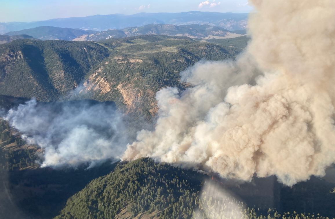
The Keremeos Creek Wildfire near Penticton in the southern Okanagan on July 29, 2022. (Courtesy Twitter/BC Wildfire Service)
“Over the month of July, we did see hotter-than-normal temperatures observed through the interior of B.C. but what was most important was the below-normal precipitation across most of the province,” explained Neal McLoughlin, a superintendent of predictive service at the BC Wildfire Service.
That led to a drying out of terrain and fuels, with parts of the province recording “some of the hottest conditions we’ve seen yet this season.”
As a result, fire danger ratings across the province have increased.
Related articles:
-
Keremeos Creek wildfire grows amid efforts to contain blaze near Penticton
-
Campfire ban for Kamloops Fire Centre
-
B.C. wildfire risk expected to ramp up this month
-
Campfire ban in Lower Mainland, Vancouver Island starting Thursday
“What’s most concerning about high-pressure ridges is when they break down and that’s indeed what happened toward the end of July. When those ridges of high-pressure break down, lightning, gusty winds are typical and expected. That’s indeed what we saw. Over 35,000 lightning strokes were recorded during the last week of July in the southern and northeast portions of B.C. and as a result, we had 121 new fire starts in that period — 74 per cent of them were lightning caused,” he explained, adding strong winds have also fuelled fast-moving fires and aggressive behaviour.
Advertisement
Meanwhile, the expectation is that August into early September will be a period of above average temperatures. McLoughlin says the good news for the current time period is that drought conditions are not above average for this time of year in many areas.
“In fact, parts of the province are actually below normal for our drought code, which is a good thing,” he said.
Despite this, he is urging people to be cautious, saying risks remain.
“The signal for those above-normal temperatures is certainly greater in eastern Canada but it is present over British Columbia through the month to come. There isn’t a very clear signal for precipitation so we’re expecting around normal precipitation amounts through the month of August and into September for B.C.,” McLoughlin said of the outlook, though he notes there’s “generally low confidence in the long-range precipitation forecasts.”
Advertisement
As the fire danger risk increased in recent weeks in some parts of the province, B.C. brought in new fire bans for the Coastal Fire Centre and the Kamloops Fire Centre.
In these areas, campfires are prohibited. People are also being reminded to be extra careful in the backcountry, with the potential for fires increasing.
As we look ahead to the coming weeks, McLoughlin says it’s anticipated that August will see similar trends to what B.C. experienced in 2011 and 2020, giving parallels in conditions.
“Despite that increased fire activity through August, I want to remind folks that we are below normal for number of fires … but also in terms of area burned,” McLoughlin added.
“This is mostly due to the fact that we had above normal over winter precipitation amounts, cool temperatures in the spring, a late snowmelt, and really a late start to the fire season. We’ve had a two-week dry spell which has increased fire danger but nothing compared to over a month of drying that we saw in previous years.”
Advertisement
Seasonal temperatures are expected to return by October, according to the seasonal outlook.
