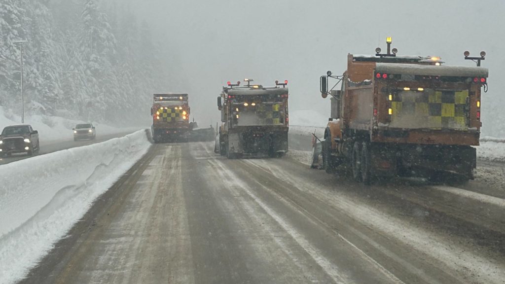
Winter storm warning issued for Coquihalla Highway
Posted February 24, 2024 12:41 pm.
It may have looked like spring in the Lower Mainland last week, but winter is far from over across B.C.
Environment Canada has issued winter storm warnings for some major highways in the province this weekend, with the conditions extending into Sunday evening.
Up to 40 centimetres of snow is expected to fall on the Coquihalla Highway, Highway 3, and the Trans Canada Highway.
“A storm system crossing B.C. this weekend will bring heavy snow to the mentioned routes,” Environment Canada said in its alert. “Periods of snow is forecast to intensify overnight with heavy snow expected through the day on Sunday. With warm air in the valleys, lower elevations of the highway routes will be raining.”
Specifically, the stretches affected are:
- On the Coquihalla Highway: between Hope and Merritt;
- On Highway 3: between Hope and Princeton via Allison Pass, and also between Paulson Summit and Kootenay Pass;
- On the Trans Canada Highway: between Eagle Pass and Rogers Pass.
Strong gusty winds are also expected, which can reduce visibility suddenly.
“Consider postponing non-essential travel until conditions improve,” the warning said. “Prepare for quickly changing and deteriorating travel conditions.”
Metro Vancouver might see snow next week as cold front moves through
Metro Vancouver may see some snow Tuesday and Wednesday; CityNews Meteorologist Michael Kuss says a mix of rain and snow are on the way to both coastal areas and higher elevations.
“The ingredients in place include cold arctic air and Pacific moisture, but the exact impact will depend on how far the cold air pushes inland.”
Kuss says the heaviest snowfall accumulation will be found inland, towards the Fraser Valley. However, it’s still too early to say just how much snow might fall.
With files from David Nadalini and Charlie Carey.