Massive storm brings rain, flash freezing to Southern Ontario
Posted December 21, 2022 3:48 am.
Last Updated December 22, 2022 8:44 am.
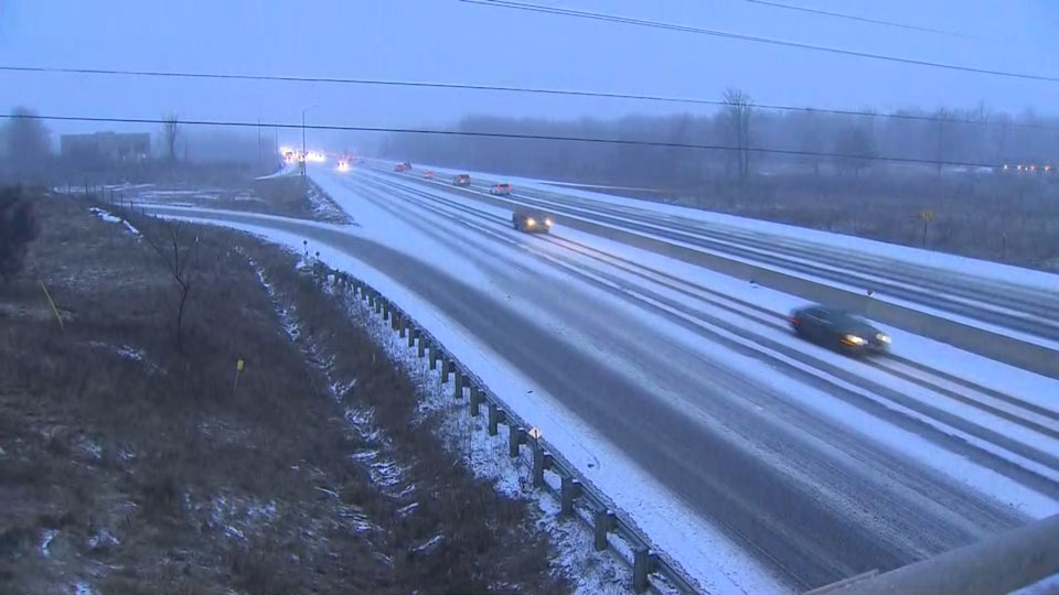
A winter storm watch is in effect for the Greater Toronto Area which has the potential for a messy weekend that could disrupt holiday travel plans.
The storm is expected to hit the city as light rain, snow or a mix of both on Thursday before a cold front arrives later Friday.
CityNews weather specialist Denise Andreacchi says 15 to 20 millimetres of rain should fall on Thursday before snow and potentially damaging winds move in. Snow could mix with the rain at the beginning of the storm but it is expected to initially melt on contact.
“It will transition to rain Thursday night because temperatures are going to actually climb,” Andreacchi says.
Thursday will see a guaranteed high of 4 C.
Environment Canada says temperatures are expected to plummet on Friday morning leading to a potential flash freeze. The rapidly falling temperatures will be accompanied by damaging winds along with snow, heavy at times.
Friday will see another high near 4 C before temperatures drop with a high of -7 C expected on Saturday — with the windchill it will feel closer to -17.
“Wind gusts of 90 to 100 km/h creating widespread blowing snow which will significantly reduce visibility,” the national weather service said with snowfall amounts of between five to 15 cm possible by Christmas Eve.
“Travel is expected to be hazardous due to reduced visibility in some locations,” reads the statement in effect for Toronto, Mississauga, Brampton, Vaughan, Richmond Hill, Markham, Caledon and Hamilton. “Avoid travel if possible.”

Travellers advised to consider altering plans ahead of storm
The incoming storm is also expected to compound travel issues at Pearson airport.
Toronto Pearson has announced that the lead-up to Christmas is expected to be the busiest travel time of the year, starting this week.
Bad weather on either side of the country has already resulted in hundreds of flight cancellations.
A statement from Vancouver’s airport says it halted all international arrivals for about 48 hours to deal with “congestion” caused by 27 centimetres of snow Tuesday.
The restriction, affecting 17 airlines and approximately 30 flights, is to lift at 5 a.m. Friday.
At Pearson, officials have advised travellers to check with their airline because airport operations could be affected by a storm forecast to arrive Thursday and potentially cause blizzard conditions the next day.
A statement from Air Canada suggests nearly 600 of its flights haven’t been completed over the last five days.
About 935 Air Canada flights depart every day worldwide, it said, with a flight completion rate “well above” 98 per cent since the beginning of December.
But over the past five days, the rate dropped to 87.25 per cent, the statement said, citing storms in Ontario and B.C.
Air Canada said travellers should rebook online if their flight is scrubbed, while WestJet is offering full refunds to passengers choosing to cancel proactively.
A statement from WestJet showed 86 flights cancelled Wednesday, a number that was expected to rise throughout the day.
It said 240 flights were grounded Tuesday due to disruptions in Vancouver along with frigid temperatures in Calgary and Edmonton, while 250 flights were cancelled Sunday and Monday.
With files from The Canadian Press