Vancouver heat records break amid temperature spike
Posted May 16, 2023 11:11 am.
Last Updated May 16, 2023 11:14 am.
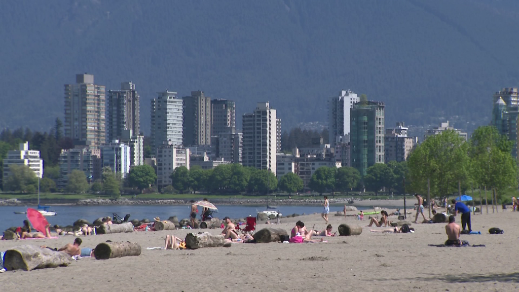
The high temperatures B.C. experienced Monday weren’t just uncomfortable for some — they were record breaking in many areas.
Records for May 15 fell in several areas, including around Vancouver, West Vancouver, Abbotsford, and Pitt Meadows in the Lower Mainland. Across B.C., a total of 37 were broken.
Vancouver International Airport recorded a high of 24.3 degrees Monday, breaking the previous record of 24.2 set in 2006.
In West Vancouver, the mercury rose to 30.3 to start the week, surpassing the previous high of 27.6, also from 2006.
Related articles:
-
Part of Metro Vancouver, Fraser Valley under air quality advisory
-
BC Hydro demand expected to be record-breaking during peak heat
-
B.C. breaks more than 4 dozen single-day heat temperature records over weekend
Meanwhile, farther east, Abbotsford recorded a temperature of 31.6, breaking the 2006-set record of 30.2.
In Pitt Meadows, the mercury rose even higher, hitting 33.1 degrees Monday, higher than the previously set high of 30 in 1895.
Those who headed up toward the Sea to Sky area for some relief wouldn’t have found much, with temperatures rising to 34.3 degrees in Squamish, and a whopping 35.9 in the Pemberton area. The previous record in the former was 31.5, while it was 30 in Pemberton.
Monday’s unseasonable extreme heat was just the tail end of a hot spell that moved through much of the province over the weekend.
Both Saturday and Sunday saw historic highs fall, with more than a dozen single-day temperature records broken.
Andrew Pershing, the director of ClimateScience, previously said climate change is going to make heatwaves like this one a lot more common.
“Some of them have happened in the past. This is not like a totally unprecedented kind of event. But it’s that the frequency of these events are becoming so much more likely and more common in this climate. And so the more CO2 (carbon dioxide) that goes in the atmosphere, the more of these kinds of heat events you’re likely to get,” he said.
Fire danger rating already high to extreme in NE BC. Quickly climbing across the South with no rain in sight for at least the next 7 days. Could see rare campfire bans for the May Long Weekend. @CityNewsVAN pic.twitter.com/lPCR3MFBuX
— Michael Kuss (@Kusswx) May 15, 2023
CityNews Meteorologist Michael Kuss says while temperatures remain high — about 10 degrees above average for this time of year — they won’t be as sweltering as they were over the past few days.
“There’s a low-pressure system we’ve been talking about down in Washington, eastern Washington now. It’s upper level but what it’s doing is it’s shielding us from some of that extreme heat that we had yesterday,” he said Tuesday.
Listen to CityNews 1130 for weather updates every 10 minutes after traffic on the ones. You can also follow us and Meteorologist Michael Kuss on Twitter and sign up for breaking news alerts sent directly to your inbox.