Forecast changing as low B.C. snowpack sparks concerns
Posted February 12, 2025 6:40 am.
Last Updated February 12, 2025 11:06 am.
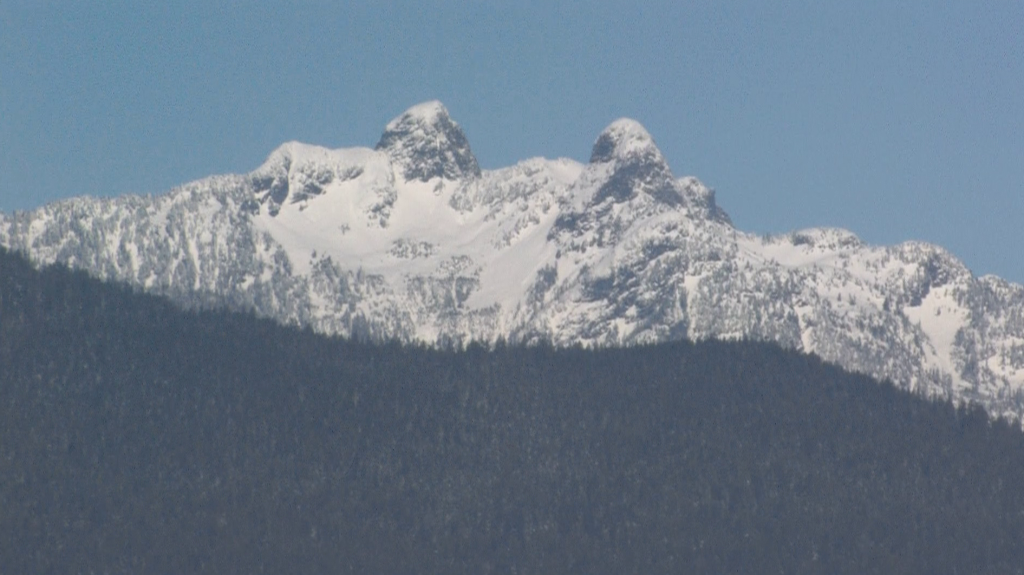
Snowpack levels in B.C. are prompting fresh concerns about what the province could look like this spring and summer.
The latest snowpack figures released Tuesday come after the province started the year with a snowpack at 13 per cent below normal. As of Feb. 1, it was 28 per cent below normal.
1130 NewsRadio Meteorologist Michael Kuss says this comes on the heels of one of the driest Januarys going back to the mid-1980s.
CLICK HERE TO LISTEN TO 1130 NEWSRADIO VANCOUVER LIVE!“Across not only the South Coast but into the Interior as well. The weather pattern, mind you, is changing … and could last until the end of February. So, it’s not too late to build up that snowpack along the coastal ranges and into the Interior as well,” Kuss explained.
He adds the concerns around the snowpack actually started at the tail end of last fall and early winter.
“It was well above average, in terms of precipitation was concerned, but temperatures were warm, so even over a lot of those mountain tops, we were seeing that precipitation fall as rain, and the snowpack did not build up substantially,” Kuss said.
“Now we’re coming off an incredibly dry January and the start of February and that’s contributed to the lack of snow in the mountains.”
Despite the cool temperatures as of late, it hasn’t improved things on the local ranges.
“It’s been Arctic high pressure that’s been the dominant player and that means dry conditions,” Kuss explained.
The bulletin, which was released by the Ministry of Water, Land and Resource Stewardship, says last month fell within the top 10 driest Januarys across much of the province. Abbotsford, Penticton, Kelowna, Vernon, Cranbrook, and Chetwynd were in the top five since record-keeping began.
The snowpack dropped throughout January in most regions, plunging by 35 per cent on Vancouver Island by the start of February.
The bulletin says areas with below-normal snowpack show “early concerns” for drought conditions in the spring and summer, while areas with near-normal snowpacks may have a higher risk of flooding this spring. However, that all depends on where you live.
There’s also a high degree of variance across the province, ranging from 20 to 108 per cent of normal. The western Upper Fraser basin is sitting at 92 per cent, while snowpack in the Skagit was sitting at just 20 per cent of what’s considered typical.
Listen live to 1130 NewsRadio Vancouver weather updates every 10 minutes after traffic on the ones. You can also follow Meteorologist Michael Kuss on X and subscribe to breaking news alerts sent directly to your inbox.
With files from The Canadian Press.