B.C.’s South Coast to get even more snow
Posted March 1, 2023 6:56 am.
Last Updated March 1, 2023 7:34 am.
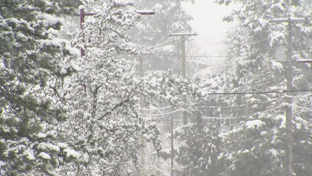
Not one, not two, but a third winter storm is about to hit B.C., following Tuesday morning’s wild weather that led to dozens of car crashes, partial bridge closures, stuck buses, long line-ups to get on the SkyTrain and dozens of flight cancellations at Vancouver International Airport (YVR).
A special weather statement is up for the Sea to Sky corridor and large areas of Metro Vancouver including Coquitlam, Burnaby, Vancouver, the North Shore, New Westminster, and Maple Ridge. It’s calling for anywhere between five centimetres to 15 centimetres of fresh snow by Thursday.
CityNews Meteorologist Michael Kuss says the snow will really start coming down after midnight.
“There’s a really good chance that we do see some snow at higher elevations but for a lot of Metro Vancouver, this will be more of a rain event. So, the snowfall range is pretty wide. [Dropping] as low as zero, a lot of neighbourhoods, especially down close to the water and lower elevations won’t see any precipitation in the form of snow at all, but higher elevation neighbourhoods could see as much as 5 centimetres to 10 centimetres.”
Related Stories:
-
Metro Vancouver gets another dump of snow
-
Vancouver snow: The aftermath and what’s next
-
Vancouver steps up its snow management
Kuss suggests the snow should taper off by sometime between 9 a.m. to 10 a.m. Thursday.
With there being rain in the mix, this also sets up a potentially messy Thursday morning commute.
“It’s going to be more of your classic coastal mix, where a lot of neighbourhoods see rain down along the water. Southern parts of Metro Vancouver probably [won’t see] snow at all but up against the mountains and higher elevation neighbourhoods, even around the City of Vancouver, will be in that five centimetre to maximum 10-centimetre range, but a lot of spots aren’t going to see any precipitation in the form of snow. You’ll get rain as the system moves through.”
Related Video:
Meantime, The Weather Network is out with its spring forecast, and it looks like we’ll need to be patiently waiting for spring-like weather from March to May.
“It appears that winter will attempt to make up for lost time during March and even into April. Several more rounds of wintry weather are expected across the country before spring finally hits its stride,” says the network.

The Weather Network’s Spring forecasts for different parts of the country.(Photo via The Weather Network)
For B.C. it says spring will start with below-normal temperatures, cooler weather overall and above-normal precipitation. The upside to that is it reduces the risk of an early start to the wildfire season and can help fill up reservoirs before we head into the long, hot, dry summer months.
Spring in B.C. begins March 20.