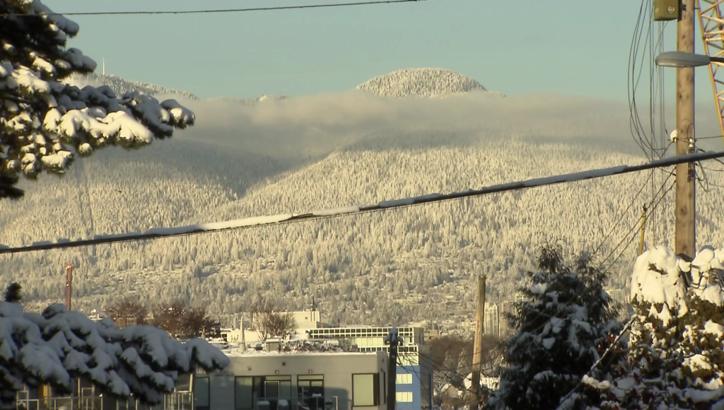
Snow is back in the Metro Vancouver forecast
Posted January 19, 2023 6:35 am.
Last Updated January 19, 2023 6:40 am.
Just when we thought we were done with it, snow is back in Metro Vancouver’s sights.
CityNews Meteorologist Michael Kuss says a cooler weather pattern is set to hit the region which will see the area get back to seasonal normal lows — around zero degrees overnight with daytime highs up to about six degrees.
“So when you see average lows of zero, the risk is there for snow or precipitation that’s at least mixed snow. We have that in the forecast for Saturday,” Kuss explained. “It does look like a rain event Saturday morning with a caveat that some higher elevation neighborhoods could see some mixed precipitation.”
While there’s another cold weather front coming in on Monday, Kuss says he doesn’t expect widespread snow then, either.
“The only precipitation after that … next week comes on Monday and I’m not expecting anything really in there, flurries flying or very light showers. That’s about it.”
Kuss’ forecast comes after B.C.’s South Coast has seen unseasonably warm temperatures for the last couple of weeks, with daytimes highs of 12 degrees seen in the region.
“There has been a little bit of a buzz about possible snow coming in on Monday, but the system coming through is so weak if we do get snow it would be incredibly light — a trace possible, or even if just showers, we’re only looking at a couple of millimeters.”
Listen live to CityNews 1130 every 10 minutes on the ones for any major weather updates. You can also follow us on Twitter @CityNewsTraffic or subscribe to breaking news alerts sent directly to your inbox.