Power outages, cancelled ferries as wind storm hits Lower Mainland
Posted January 9, 2024 6:53 am.
Last Updated January 9, 2024 3:06 pm.
While umbrellas and snow boots can be left at home, it might be a good idea to bundle up Tuesday as a wind storm is hitting parts of B.C.’s South Coast.
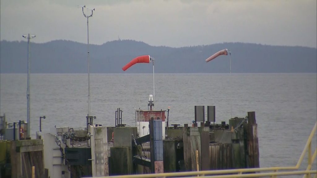
Environment and Climate Change Canada (ECCC) issued a wind warning for southern sections of Metro Vancouver, specifically those near the water.
CityNews meteorologist Michael Kuss explains winds will become stronger as the morning goes on before tapering off into the afternoon.
“They’re still going to get stronger than they are now over the next two to three hours and then back off,” he said. “It’s also unsettled. … We could even see isolated thunderstorms this afternoon.”
ECCC is expecting winds to hit 70 kilometres an hour, gusting to 90 km/h.
“Loose objects may be tossed by the wind and cause injury or damage. High winds may result in power outages and fallen tree branches,” it said.
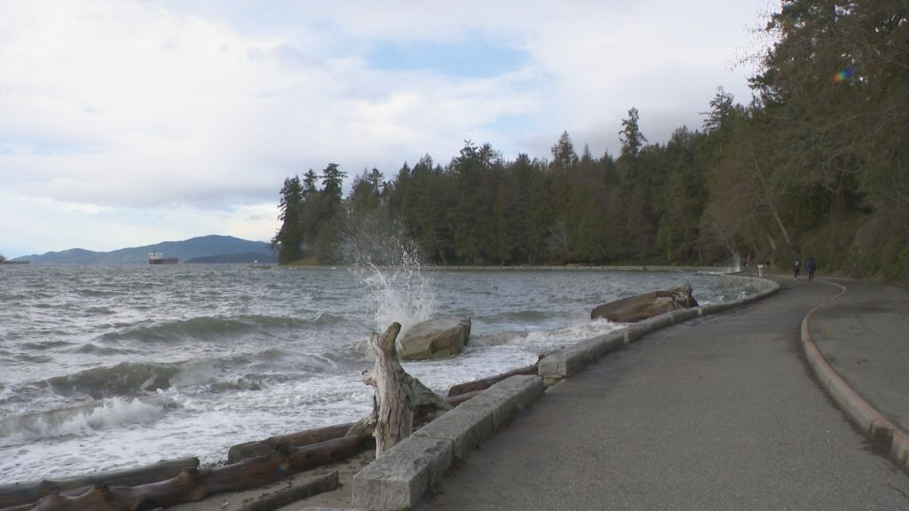
ECCC adds that significant waves are also expected Tuesday, “likely exceeding highest astronomical tide.”
“Large waves due to gale-force southwest winds, storm surge and seasonably high tides have the potential to produce high water levels for today. Coastal flooding is possible along exposed shorelines, especially in low-lying areas,” the weather service said.
Kuss says temperatures across the Lower Mainland will hit about seven or eight degrees Tuesday, with Wednesday also above seasonal before “arctic air shoots in just in time for the weekend.”
BC Ferries has cancelled the first two sailings between Tsawwassen and Victoria due to windy weather out on the water.
The first sailing to Swartz Bay is scheduled to proceed at 11 a.m., however, it might still be cancelled as the wind is expected to ramp up as the day goes on.
However, if you’re in need of getting to Vancouver Island, it might be a good idea to use the Horseshoe Bay terminal — sailings are heading out as scheduled.
Metro Vancouver and the Fraser Valley are also seeing scattered power outages.
Blackouts in Maple Ridge, Burnaby, Surrey, and Hope affected almost 5,000 customers early Tuesday morning.
Meanwhile, if you thought the snow went away with the warmer temperatures, think again. Snow will return later this week along with frigid temperatures.
Kuss explains the arctic air will mix with a pacific weather system over the Lower Mainland come Thursday.
“Two to five centimetres [of snow] is possible. Strong winds and cold air will last through the weekend,” Kuss said.
“Highs won’t get above freezing and wind chills will be in the minus double digits from Friday through Sunday.”
Listen to CityNews 1130 for weather updates after traffic every 10 minutes on the ones. You can also follow Meteorologist Michael Kuss on X and subscribe to breaking news alerts sent directly to your inbox.