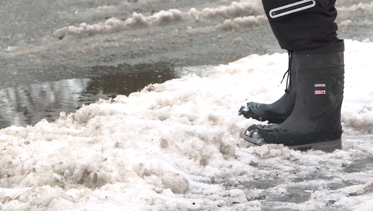
Metro Vancouver to see heavy rain turn to snow
Posted January 30, 2025 6:46 am.
Last Updated January 30, 2025 8:18 am.
The first substantial rain all year is headed toward B.C.’s South Coast on Thursday.
The downpour comes before the region will see a big drop in temperature and the flurries start.
“The weather system, moving in from the Pacific, is going to mix with some arctic air,” 1130 NewsRadio meteorologist Michael Kuss explained.
CLICK HERE TO LISTEN TO 1130 NEWSRADIO VANCOUVER LIVE!“This is plunging down from the north, and that mixing, which looks to be taking place right over the Lower Mainland, we will see some snow building in overnight tonight, mainly this evening and overnight, with three to five centimetres of snow possible at high elevation neighbourhoods on the North Shore all the way through the Tri-Cities, Pitt Meadows, Maple Ridge, Mission, and Abbotsford as well.”
If you’re planning on heading north to Whistler, you’re in for a treat on the slopes but a very slippery and slow drive to get there.
“In Sea to Sky country, there is a snowfall warning from Squamish to Whistler, where we could see 10 to 20 centimetres of snow in that corridor,” he said.
But Kuss clarifies the first precipitation the region will see is heavy rain.
“The first phase is mainly a rain event. Rain ramps up this afternoon all the way through Friday,” he explained.
When it comes to the weekend, Kuss says the temperatures will drop through to next week.
“With cold air plunging in, that rain is going to turn over to snow for high-elevation neighborhoods, and we’re going to see arctic air setting up for the weekend, and it really gets cold next week,” he said, adding the biggest snowfall could come on Sunday.
Meanwhile, Environment and Climate Change Canada echoed Kuss and issued a special weather statement Thursday for much of B.C.’s South Coast.
“A wintery mix of weather conditions are expected to impact the South Coast of B.C. for the next several days. A low-pressure system is making its way towards the B.C. coast with steady precipitation beginning this afternoon,” the weather service stated.
“Due to initially low freezing levels, wet snow is likely over higher elevations with some areas receiving near 4 cm by Friday morning when the snow is expected to change to rain for most regions,” it added.
While snow accumulation totals are “uncertain” for the weekend, ECCC says snow is likely in many areas.
“Warnings will be issued as necessary,” the weather service added.
“By early next week very cold and dry air is expected over the South Coast with outflow conditions from an arctic ridge of high pressure settling over the region.”
Listen live to 1130 NewsRadio Vancouver weather updates every 10 minutes after traffic on the ones. You can also follow Meteorologist Michael Kuss on X and subscribe to breaking news alerts sent directly to your inbox.